

1. Hyperdimensional Prospectivity: Integrating Spatial, Deep-Time Spatiotemporal Data and Artificial Intelligence for Mineral Discovery
Workshop convenor/Contact: Satyam Pratap Singh, Dietmar Müller, Jan Norbisrath, Utpal Singh (The University of Sydney / Geonome Pty Ltd)
Days: 1
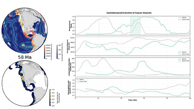
Mineral deposits form in response to dynamic tectonic and geodynamic processes that operate over deep time. However, conventional prospectivity approaches rely almost exclusively on present-day geoscience datasets. This workshop introduces hyperdimensional prospectivity—a new framework that fuses spatial geodata with time-evolving plate tectonics and geodynamic parameters to reveal where ore-forming conditions have recurred across multiple tectonic cycles. Participants will learn to use Kalpa, a next-generation geospatial and spatiotemporal AI platform designed for mineral exploration. Through instructor-led demonstrations and guided hands-on sessions, the workshop will cover: Multisource geodata integration (geophysics, geology, geochemistry, remote sensing) ML methods, including PU-learning, oversampling, and deep learning. Incorporation of deep-time tectonic and geodynamic variables (convergence rates, slab geometry, crustal thickness) Construction of spatial and spatiotemporal prospectivity models Interpretation of probability maps, uncertainty, and metallogenic persistence A complete workflow is demonstrated for Porphyry Copper systems in the North American Cordillera, highlighting discovery insights and frontier targeting opportunities. This workshop equips participants with practical skills to build 4D models, integrate open-source tools (GPlates, pyGPlates), and apply Kalpa to real exploration problems. No advanced coding background is required. Participants are required to bring their own laptop.
2. Designing successful SIMS studies of ore deposits
Workshop convenor/contact: Laure Martin (UWA) and Joelle D'Andres (ANU)
Days: 1
Extracting meaningful isotopic data from ore minerals demands more than instrument time, it requires careful project design, from sample selection through to data reduction. This workshop takes participants through the complete workflow for planning and executing Large-Geometry Secondary Ion Mass Spectrometry (LG-SIMS) studies of ore deposits, with strategies adaptable to different isotope systems and mineral targets.
We will begin by showing how mesoscale characterisation techniques, such as LIBS and micro-XRF can be used to assess complex geological samples and select optimal regions of interest before proceeding to microscale analysis. Participants will then work through sample preparation and mineral characterisation, with particular attention to textural analysis and management of potential matrix effects.
A laboratory visit will provide hands-on exposure to SIMS instrumentation and to the practicalities of an analytical session. The workshop will conclude with data reduction, quality control, and strategies for assessing the robustness of SIMS datasets.
Throughout, examples from gold, Ni–Cu and base-metal mineral systems will illustrate how integrated characterisation and SIMS analysis can resolve complex mineral growth histories, fluid-rock interactions, and provide new constraints on metal mobilisation and ore formation. Participants will leave with a transferable framework for designing SIMS studies tailored to their own research questions.
3. Iron-oxide Cu-Au deposits of the Olympic Cu-Au Province, SA
Workshop convenor/contact: Adrian Fabris, GSSA; Kathy Ehrig, BHP; Invited industry speakers
Days: 2
26th-27th Aug
Iron oxide copper-gold (IOCG) deposits form some of the world’s most significant mineral deposits. Since the discovery of Olympic Dam, IOCG deposits have been recognized elsewhere in the Gawler Craton and in a number of terranes world-wide leading to significant advances in the understanding of their formation and diversity.
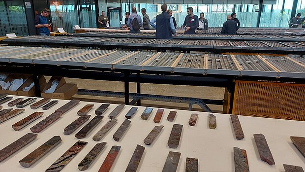
This core display and associated workshop will showcase South Australia’s IOCG deposits including detailed descriptions of major deposits facilitated by the Geological Survey of SA, BHP and various experts.
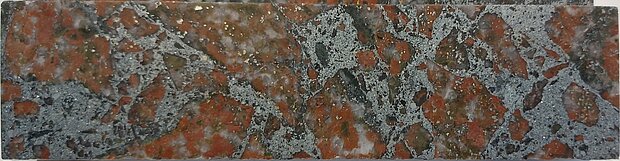
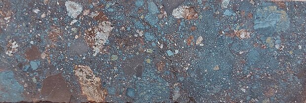
Drill core will include examples from Olympic Dam, Carrapateena, Prominent Hill and Oak Dam. The workshop will cover key characteristics of the IOCG deposit style, with an emphasis on hematite-dominant deposits.
All attendees will need to organize their own travel to Adelaide and overnight accommodation for this workshop.
Course Takeaways
- Characteristics of the IOCG deposit class
- Discuss and see examples of the diversity in the deposit class, including high to low temperature alteration mineralogy
- Compare and contrast world-class and sub-economic IOCG occurrences
- Understand the ingredients necessary to form high-grade mineralisation
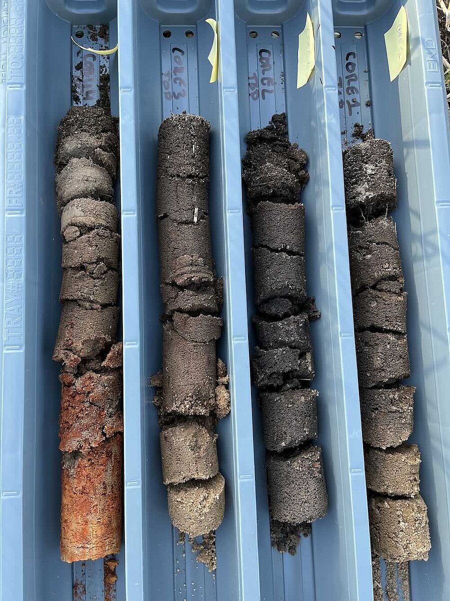
4a. Regolith geochemistry and landscape context with an emphasis on semi-arid terrains
Workshop convenor/contact: Ryan Noble (CSIRO), Walid Salama (CSIRO), Anicia Henne (CSIRO)
Days: 1.5
This short course provides a comprehensive introduction to the mineralogical and geochemical characteristics of regolith, with a focus on their application in exploring terrains dominated by weathered cover. Participants will gain a foundational understanding of key concepts in regolith science, including terminology, mineral stability, and the chemical processes that operate during weathering. The program emphasizes regolith mapping, the formation and transformation of lateritic profiles, and the influence of paleoclimate variations and tectonic uplift on the evolution of landscapes. In addition, it offers detailed insights into the geochemical dispersion of elements, the selection of appropriate sampling media, and the development of exploration models for relict, erosional, and depositional environments.
The course also explores modern approaches to soil and ultrafine fraction sampling, interface sampling and the use of indicator minerals, as well as the integration of machine learning techniques for landscape interpretation and mineral exploration in complex regolith-dominated regions.
For interested participants, workshop 4b. is an in-depth and practical extension of an industry-ready machine learning technique for landscape interpretation and geochemical outlier detection available for the Australian continent.
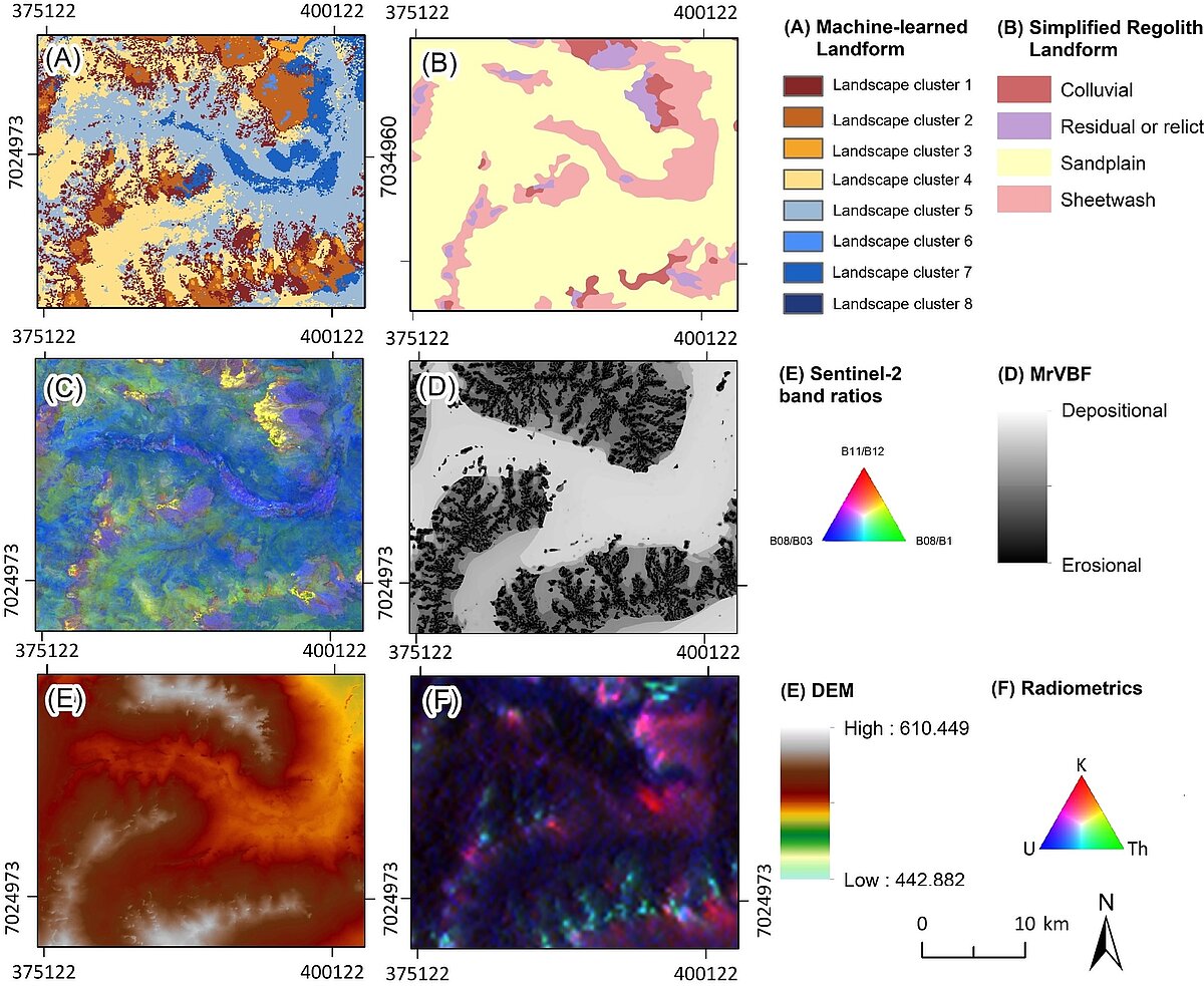
4b. LandScape+ Regolith interpretation and geochemical data analysis tool
Workshop convenor/contact: Ryan Noble (CSIRO), Anicia Henne (CSIRO)
Days: 0.5
This is workshop is designed to learn how to generate and interpret machine learned landscape types and assess geochemical outliers from your soil surveys using LandScape+—a web-based tool designed for surface exploration in Australia.
Traditional geochemical analysis often treats all samples as a single population, ignoring the physical landscapes that influence metal dispersion. With LandScape+ geologists can create landscape-type maps from public spatial data sets, treat samples as sub-populations based on landscape types, identify true geochemical anomalies with greater confidence and use outputs to plan the next exploration steps
This workshop guides participants through the complete workflow of LandScape+® using an example project. Participants will gain practical skills for surface geochemistry and the scientific background insights to improve survey planning and data interpretation.
Whilst not a pre-requisite, participants without prior knowledge of regolith geochemistry and landscape evolution may benefit from attending Workshop 4a "Regolith geochemistry and landscape context with an emphasis on semi-arid terrains"
Please note that LandScape+(R) is currently exclusively available in Australia due to data coverage with some test work being done in other countries to support future application more broadly.
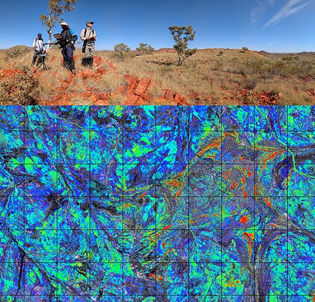
5. Earth Observation Information for regolith mapping, mineral exploration and mine site monitoring
Workshop convenor/contact: Carsten Laukamp - CSIRO/IEEE GRSS GSIS/EOA, Australia; Nicola Mondillo – University of Naples, Italy; Saeid Asadzadeh – GFZ Potsdam, Germany; Richard Gloaguen – HZDR Freiberg, Germany
Days: 2
This workshop will introduce optical and other EOI (e.g. SAR, radiometrics) for mineral resources applications, including processing workflows and ground validation strategies, using case studies from Australia, South America and Africa.
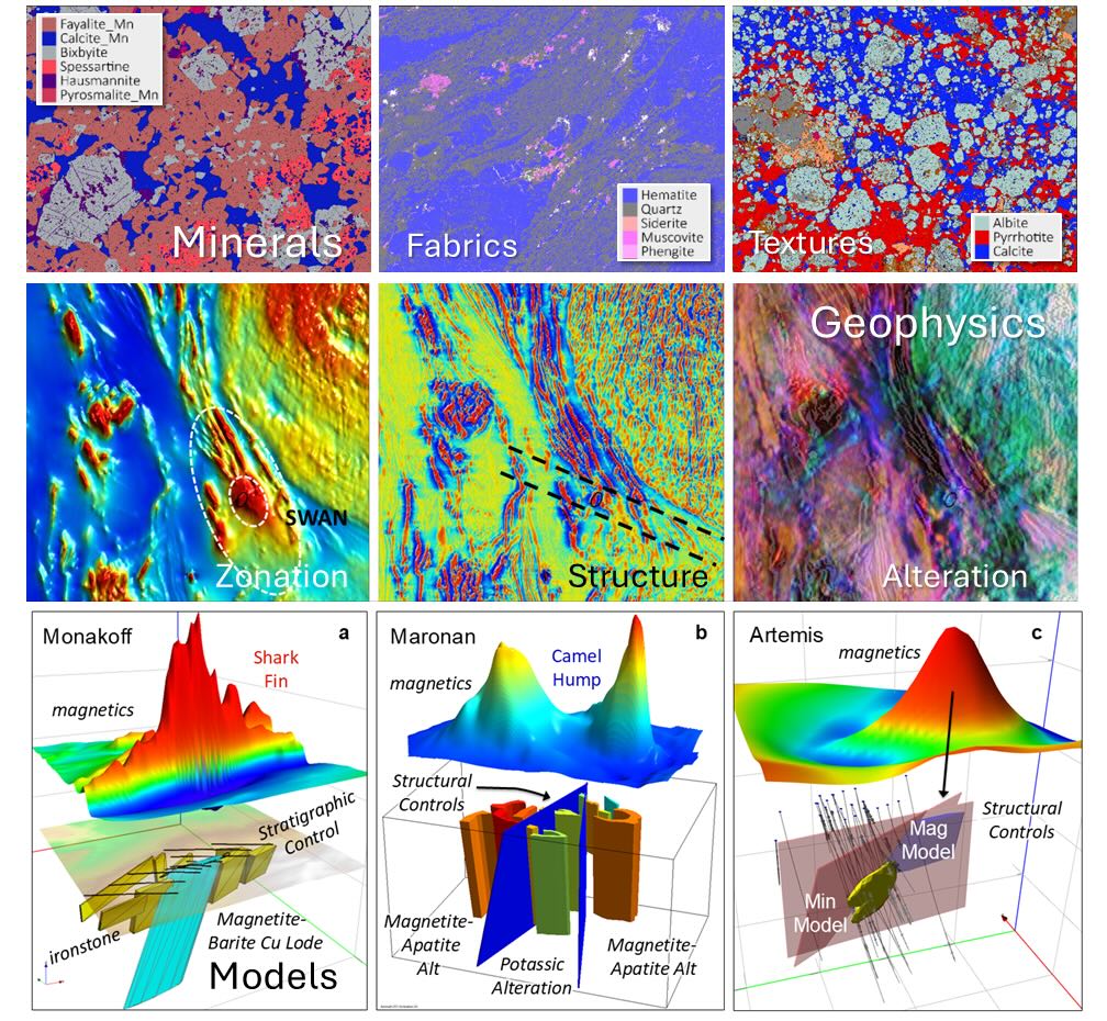
6. Geophysical Approaches to Mineral System Science and Exploration
Workshop convenor/contact: Jim Austin (CSIRO), Stephan Thiel (CSIRO), Shane Mule (CSIRO)
Days: 1
This workshop will showcase the application of Geophysics to mineral system science. Targeted at mineral explorers and economic geologists, the program will blend high level overviews on a range of techniques with relevant, relatable case histories. Presenters will demonstrate geophysical approaches to exploration through cover from regional to camp scale, mantle to cover, and outline key geophysical signatures covering a range of deposit styles and commodities (e.g., Cu, Au, Fe, Ni, PGE and other critical minerals). We will explore how integration of geophysics and petrophysics, both across scales and with other geoscience data, can help answer some of the fundamental questions of mineral system science: What can geophysics tell us about Geodynamics, Architecture, Fluids sources, Pathways and Depositional Controls?
7. New tools for mineral exploration
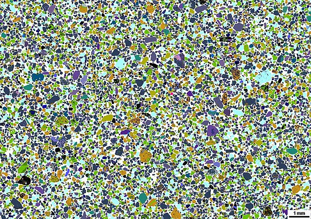
Workshop convenor/contact: Louise Schoneveld (CSIRO), Anicia Henne (CSIRO)
Days: 1
This workshop will cover the new and emerging, practical exploration tools for all commodities. If you are interested in presenting new tools at this workshop please contact the workshop convenor Louise.Schoneveld@csiro.au
8. Microanalytics Applied to Mineral Deposit Characterisation
Workshop convenor/contact: Laura Petrella, Denis Fougerouse (Curtin)
Days: 2
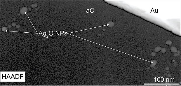
This workshop will introduce techniques such as EPMA, SIMS, NanoSIMS, ToF-SIMS, EBSD, TEM, and Atom Probe, followed by a half-day session focused on case studies.
9. The AuScope National Virtual Core Library – a treasure chest for mineral explorers
Workshop convenor/contact: Shane Mule (CSIRO), Jessica Stromberg (CSIRO), Carsten Laukamp (CSIRO)
Days: 1
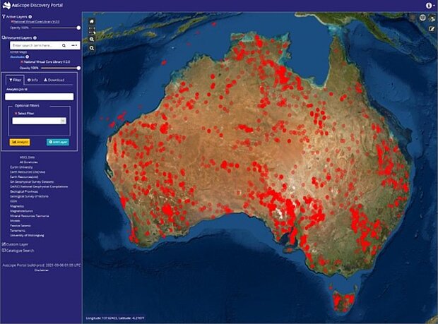
This workshop will introduce the AuScope NVCL, a publicly accessible collection of drill core mineral information from +6000 drill cores from across the Australian continent, intersecting virtually every commodity type and geological system in Australia. Attendees are invited to bring their laptops for hands-on exercises using The Spectral Geologist software.
10. Clay mineral identification and quantification using X-ray diffraction analysis
Workshop convenor/contact: Albert Gilg (Technical University of Munich)
Days: 2
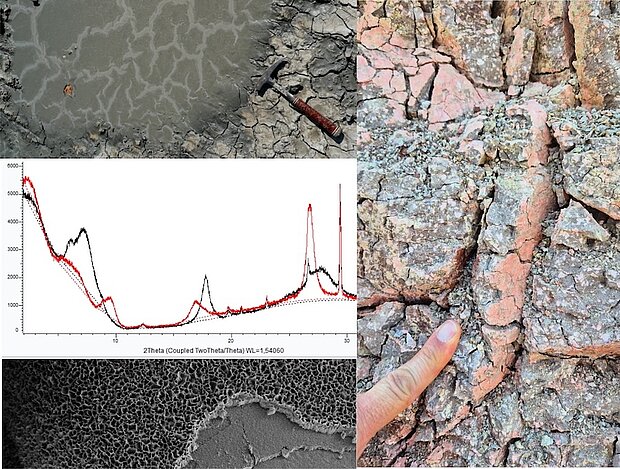
Clay minerals are common alteration phases in upper crustal mineral systems, including epithermal, porphyry, sediment-hosted and supergene metal deposits. They are useful vectors to mineralization, valuable ores of Li, Ni and Zn, and industrial minerals such as bentonite, kaolin, sepiolite or halloysite. However, they also are seen increasingly detrimental in mineral processing. Clays matter in economic geology. Their identification and quantification are inherently difficult due to their small size, structural complexity and mineralogical diversity. X-ray diffraction analysis is still the most versatile and effective method for clay mineral identification and quantification. We will address specimen preparation, clay mineralogy essentials, and strategies of identification and quantification of clay minerals with ample exercises using an open source software tool (Profex-BGMN).
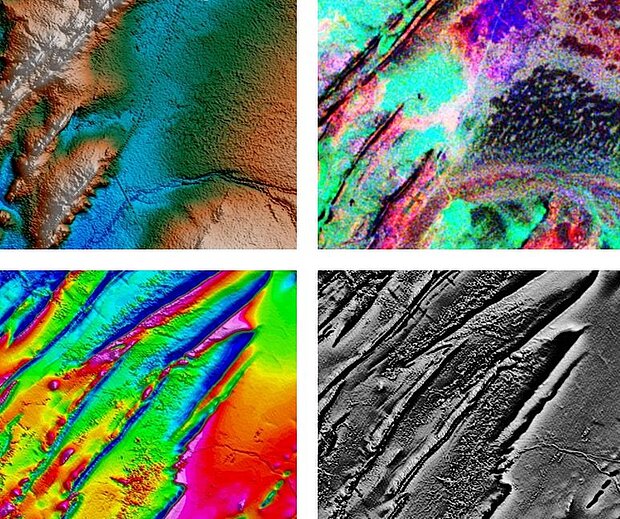
11. Exploring for Minerals using Geophysical Methods: An Introductory Course for Exploration Geoscientists.
Workshop convenor/contact: Mike Dentith
Days: 1
This innovative training course uses applied learning techniques and real-world mineral exploration scenarios to train participants in the key principles of interpreting geophysical data sets, without the need for complex mathematics and physics.
This course teaches participants to integrate geological and geophysical methods to optimise mineral exploration.
Who Should Take This Course?
- Industry, government and student geologists seeking to understand how to use geophysical datasets to explore and map
- Geophysicists seeking to improve their interpretation skills
Why Take This Course?
The future of mineral exploration is searching for deposits undercover and geophysics will play an increasingly important role in exploration success.
Explorationists must be comfortable using geophysical data sets and understand what they can and can not tell us about the geological environment
Key Outcomes
- Capability in best-practise geophysical interpretation
- Ability to solve exploration challenges with geophysical data sets
- Understanding the capabilities and limitations of various geophysical data types
- Awareness of the importance of geophysics in the future of mineral exploration
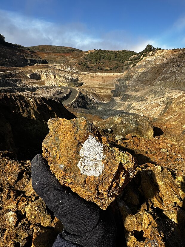
12. Metal transport and concentration processes in magmatic-hydrothermal systems: from Mantle to Ore
Workshop convenor/contact: Marco Fiorentini (UWA) & Carl Spandler (Adelaide University) & Maria Cherdantseva (UWA)
Days: 0.5
The half-day short course aims to bring together the latest understanding on the physio-chemical processes that lead to the genesis of mineral systems enriched in critical metals, with specific emphasis on source characteristics, establishment of plumbing networks conducive the effective metal transport, and concentration mechanisms across the lithosphere. The focus will be laid on a range of mafic and ultramafic systems hosting magmatic sulfide mineralisation enriched in Ni-Cu-Co-V-PGE-Au, and alkaline magmas enriched in REE-Nb.
The workshop will showcase case studies and recent research results stemming from the ARC Centre in Critical Resources for the Future, that highlight the commonalities among these apparently diverse mineral systems, putting forward the hypothesis that they are part of a metallogenic continuum. Assessment of metallogenic fertility and refinement of exploration targeting techniques will be discussed interactively.
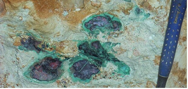
13. Exploration for Base metals (Cu, Pb, Zn) in sedimentary and metamorphosed sedimentary basins
Workshop convener/contact: Walter Witt (CET), Olivia Johnson (CET)
Days: 1
This workshop addresses the geology of sedimentary basins (metamorphosed and unmetamorphosed) and its implications for minerals exploration, focussing on the base metals (copper, lead, zinc). The program will include descriptions of well characterised and well mineralized (meta)sedimentary basins (e.g. Central African copper Belt, Kupferschiefer) and also reviews of prospective Australian basins (e.g. Canning Basin, Officer Basin).
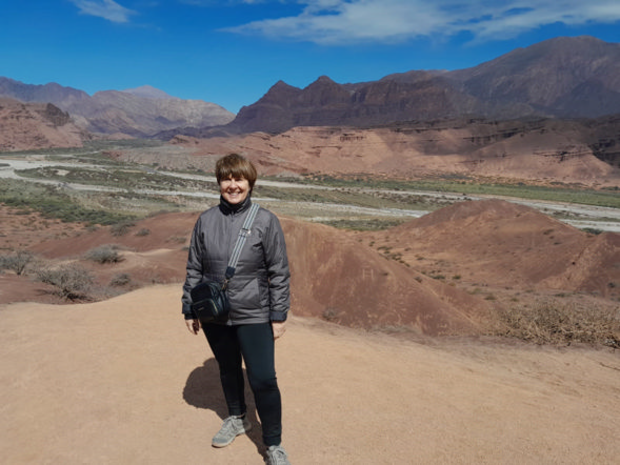
14. Metallogenesis of the Central Andes
Workshop convener/contact: Dr. Nora Rubinstein (Principal Researcher, National Scientific and Technical Research Council (CONICET); Associated Professor in Economic Geology, University of Buenos Aires (UBA).
Days: 1
The aim of this workshop is to provide a general overview on the metallogenesis of the Central Andes of Argentina. Key topics will include the main metallogenic epochs and their relationship to the regional magmatic cycles, from the Permian to the Miocene-Pliocene, discussing their regional large-scale geodynamic controls. Besides, a review of the main Cu and Au Cenozoic deposits of economic interest will be presented, including a synthesis of the structural, magmatic and hydrothermal characteristics of key Cenozoic porphyry-type and epithermal deposits.
15. Ore microscopy
Workshop convener/contact: Paul Spry, Simon Kocher
Days: 2
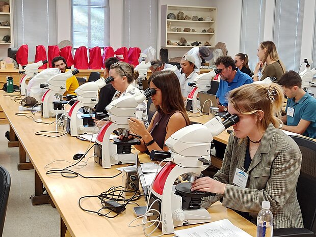
Reflected light microscopy and detailed ore petrography can provide important information on ore deposit genesis and can help to identify potential complications in mineral processing and environmental hazards during the early stages of exploration projects.
This 2-day hands-on course introduces participants to the basic principles of ore microscopy. On the first day of the course participants will be introduced to the basic principles of reflected light microscopy to allow them to confidently identify ore minerals and use the correct terminology to describe their observations. The second day will focus on ore textures and their significance on a micro- and macro-scale.
The course is aimed at economic geology and geometallurgy professionals and students seeking to gain initial insight into ore microscopy and for individuals with prior exposure to microscopy wanting to take the tarnish off their skills. Attendees will gain hands-on experience by examining a series of samples representative of various deposit types.
Upon completion of this course, participants will be able to:
- Identify a suite of common ore minerals in reflected light
- Interpret key mineral textures in multiple deposit types
- Link microtextures to deposit-scale processes
- Understand the role of ore petrography in exploration and mining operations to anticipate potential risks for mineral separation and environmental hazards
All course materials and equipment will be provided, including petrographic scopes and polished ore samples.
16. Queensland Core Library - IOCG, ISCG and more in the Cloncurry district
Workshop convener/contact: GSQ: Vladimir Lisitsin, Alkis Kontonikas-Charos, Elena Belousova
Days: 2.
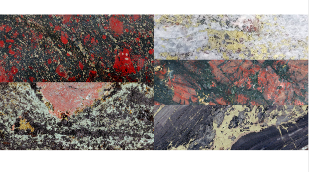
This 2-day post-conference workshop will showcase the diversity of Iron Oxide copper-gold (IOCG) and genetically affiliated deposits in the Cloncurry district of the Mount Isa Province in Queensland. Hosted in the Exploration Data Centre of the Geological Survey of Queensland (GSQ) in Brisbane, the workshop will focus on guided core viewing of representative drill cores illustrating key deposit styles of the Metasomatic Iron Alcali-Calcic (MIAC) mineral system in the Cloncurry district. Featured deposits include Ernest Henry, Eloise, Rocklands, SWAN and Maronan – as well as several recently discovered Iron Sulfide Copper-Gold (ISCG) deposits.
The workshop will include a series of introductory presentations (from GSQ experts and invited speakers) outlining the variety of deposit styles produced by the MIAC mineral system and geology of the featured deposits - including their geochemical and mineralogical signatures, latest findings on isotope geochemistry and geochronology and their genetic implications. Accompanying materials will include outputs of comprehensive drill core characterisation, including continuous hyperspectral mineralogy, micro-XRF and TIMA imagery.
17. Mine site monitoring and mine waste transformation
Workshop convener/contact: Anita Parbhakar-Fox (KCB), Olivia Mejías (SMI-UQ, ARC Centre in Critical Resources for the Future)
Days: 1
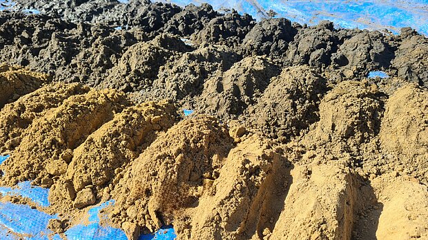
This workshop takes participants from conventional practice through to the latest innovations in tailings characterisation for environmental and reprocessing purposes. Topics covered include conventional and emerging analytical tools, reprocessing approaches, tailings resource modelling, and the policy and business developments shaping the future of the mine waste sector.
18. Integrated drillhole characterisation with LithoBound
Workshop convener/contact: Hamid Zekri and David Cohen, UNSW | MinEx CRC
Days: 1
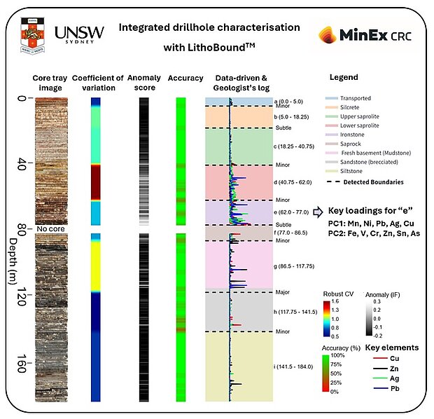
Understanding regolith development and the geological processes that influence downhole geochemical, mineralogical and petrophysical patterns is important in mineral exploration. Reliable identification of changes within drillhole profiles, including boundaries related to weathering, lithology, alteration and mineralisation, can improve geological logging, sampling strategies and interpretation.
- This full-day workshop will introduce practical approaches to the analysis and integration of drillhole datasets. It will cover univariate, bivariate and multivariate data analysis techniques, with focus on supervised and unsupervised classification methods used to recognise geological patterns and support interpretation.
- Participants will be introduced to LithoBound, a web-based application developed for objective drillhole boundary detection and geological characterisation. LithoBound integrates geochemical, spectral, petrophysical and geological data to identify significant changes within drillholes and assess the variables contributing to those changes.
- Practical sessions will use example drillhole datasets to explore data relationships, select and transform variables, identify and classify geological intervals, compare results with existing geological logs, and correlate equivalent units between drillholes. Participants will also use LithoBound to prepare cross-sections and 3D fence diagrams for interpreting geological relationships across multiple drillholes.
- Topics covered:
- Geological controls on downhole geochemical and mineralogical patterns
- Preparation, quality control and integration of drillhole datasets
- Univariate, bivariate and multivariate data analysis including unsupervised and supervised machine learning techniques
- Detection and interpretation of geological boundaries using LithoBound
- Classification and correlation of geological intervals between drillholes (Cross-sections and 3D fence diagrams)
Applications to geological interpretation, sampling and exploration targeting
Participants should bring a laptop. No programming experience is required.